XGRIDSLixel L3Handheld SLAM LiDAR Scanner
Accuracy Meets Photorealism — True-Color Point Cloud, Mesh & 3DGS in One Pass
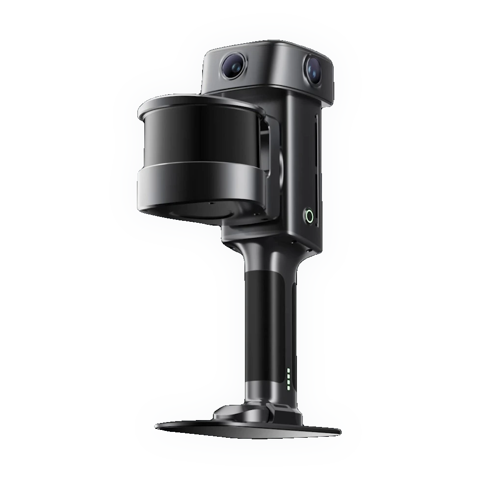
The XGRIDS Lixel L3 is a flagship high-accuracy handheld SLAM LiDAR scanner that fuses a Class 1 905 nm LiDAR, a 1/1.3" true-color camera system with 4K HDR, built-in multi-GNSS RTK, and an on-board 4.3" touchscreen into one instrument. A single pass produces a true-color point cloud, a textured mesh, and a 3D Gaussian Splat — 5 mm post-processed relative accuracy and 2 cm absolute, with real-time usable data the moment you stop walking. Full specifications →
Rev1 validates application fit, accuracy strategy, RTK workflow, and software stack before purchase. Authorized XGRIDS / Lixel partner in the USA — Auburn Hills, MI. Questions before you quote? Call Rev1 at (248) 707-2950.
Factory-Built Precision. US-Supported by Rev1.
The Lixel L3 is genuine XGRIDS hardware, sold and supported in the United States by Rev1 Technologies — your XGRIDS / Lixel partner in the USA. A survey-grade handheld SLAM scanner is a workflow decision, not just a hardware purchase — Rev1 validates accuracy strategy, RTK workflow, deliverable format, and the software stack before deployment, and supports it after.


Precision Sensing, Fused in a Single Device
Geometry, color, positioning, and delivery no longer need four boxes. The Lixel L3 fuses a Class 1 905 nm LiDAR, a true-color camera system, built-in multi-GNSS RTK, and an on-board 4.3" touchscreen into one handheld instrument — captured, colorized, georeferenced, and reviewed in a single pass.
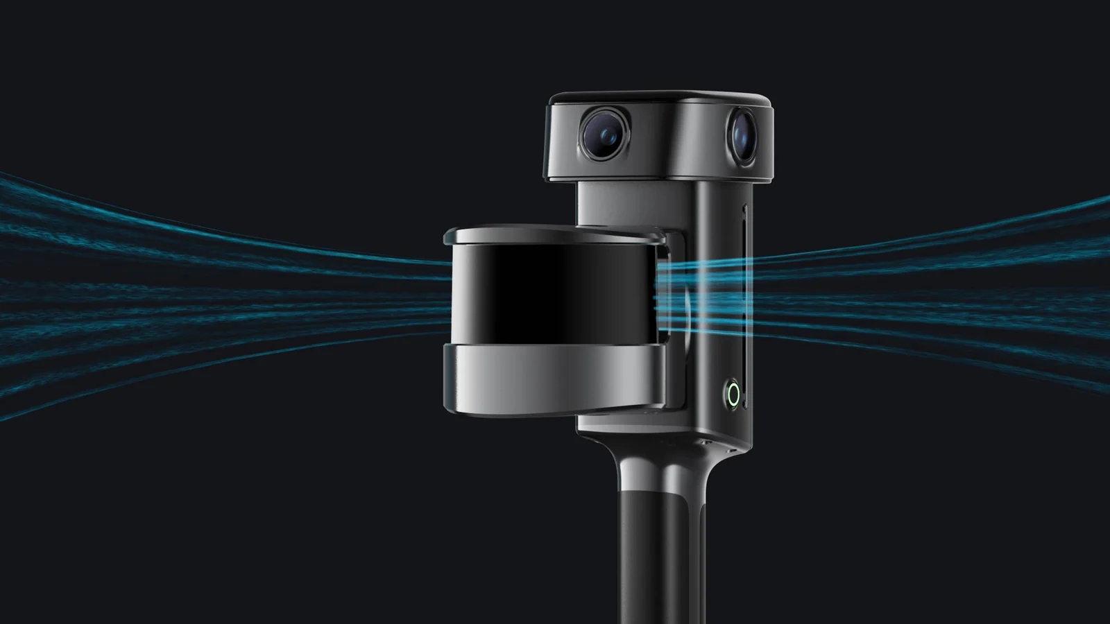
LiDAR, vision, RTK and display — one pass
The 905 nm Class 1 eye-safe LiDAR captures 320,000–640,000 points per second across a 360°×270° field of view, from 0.7 m out to 120 m. True-color vision attaches photographic RGB to every point, built-in RTK anchors it to real-world coordinates, and the integrated display lets the operator confirm coverage without a phone or laptop tether.
A New Accuracy Benchmark for Handheld SLAM
The L3 is verified against ground truth: 5 mm post-processed relative accuracy and 2 cm absolute, so the deliverable stands up as survey evidence rather than a visualization.
Survey-grade, verified against ground truth
Post-processed relative accuracy reaches 5 mm (1σ, 500 m² test environment, no ground control, versus total station). Absolute accuracy holds to 2 cm RMSE horizontal and vertical with 2 cm repeatability, and point-cloud thickness stays within 5 mm over a 10 m path. In real time the L3 delivers 1 cm relative and 2.5 cm absolute RMSE, referenced to WGS84 or CGCS2000.
Photorealistic Color, Even in Hard Light
A 1/1.3" CMOS sensor at 4096×3072, a forward camera, and two 200°×200° panoramic cameras combine with DCG 4K HDR so color stays legible in low light and high-contrast scenes — not washed out, not crushed.
1/1.3" CMOS, 4K HDR, low-light legible
The forward camera covers 100°×75° while two panoramic cameras each cover 200°×200°, so color wraps the full LiDAR envelope. DCG (dual conversion gain) HDR preserves detail across bright sky and deep shadow in the same frame, with on-demand detail enhancement where a scene needs it — fabric, foliage, signage, and fine texture survive into the deliverable.
Low Light, Still Legible
In dim interiors and dusk exteriors, DCG HDR and the large 1/1.3" sensor gather more light with less noise and less color shift, so the point cloud stays clean and true-color where lesser cameras go grainy or muddy.
One Capture. Point Cloud, Mesh & 3DGS.
A single L3 field session produces three deliverables from the same data — a true-color point cloud for measurement, a textured mesh for modeling, and a 3D Gaussian Splat for immersive review. No second visit, no separate capture per format.
True-color point cloud — measurement
Every point carries survey-grade geometry and photographic RGB, exportable to LAS, RCP, E57, PLY, and iLAS for direct use in CAD, GIS, and inspection workflows. This is the measurable, coordinate-referenced record of the site.
Textured mesh — modeling
LixelStudio reconstructs a textured mesh (OSGB, OBJ) from the same capture — ready for BIM as-built, scan-to-model, and visualization pipelines without re-scanning the site.
3D Gaussian Splat — immersive
Lixel CyberColor (LCC) turns the same session into a photoreal 3D Gaussian Splat (LCC, LCC2, PLY) for immersive review, digital twins, and virtual production — compatible with Unreal Engine and NVIDIA Isaac Sim through the LCC plugin.
Complete Data Where SLAM Usually Breaks
Urban canyons, tunnels, and reflective waterside sites are the failure modes that degrade lesser scanners. RTK fused with multi-modal SLAM keeps the L3 stable through all three — less drift, less layering, complete coverage.
Urban canyon, tunnel, and waterside
Where GNSS is blocked by tall structures, absolute accuracy holds to roughly 5 cm in the urban canyon. In featureless, repetitive spaces such as tunnels and utility corridors, multi-modal SLAM prevents the geometric layering that ruins single-sensor scans. Near reflective water, sensor fusion rejects false returns — so the deliverable is complete on the first pass.
Featureless and Repetitive Spaces
In tunnels and utility corridors where texture is weak and geometry repeats, multi-modal SLAM stays locked and keeps the point cloud continuous — no layering, no gaps where single-sensor scanners lose the track.
Waterside Sites
Near reflective water, the L3 keeps refining its solution and rejects false returns, so bridges, embankments, and shorelines come through complete and correctly placed on the first pass.
A Usable Point Cloud the Moment You Stop
Multi-SLAM, vision-aided localization, and AI dynamic-object filtering run on-device, so the cloud is measurable in real time — reviewed on the built-in 4.3" touchscreen before the crew leaves site.
On-device Multi-SLAM with AI filtering
Multi-SLAM fuses LiDAR, vision, and IMU on-device while vision-aided localization keeps the trajectory locked in low-feature spaces. AI dynamic-object filtering removes moving people and vehicles from the cloud as it builds. Everything is reviewed live on the 1000-nit 4.3" touchscreen — no phone, no laptop, no overnight batch before you know the capture is good.
Real-Time Filtering for a Clean Cloud
As you scan, AI identifies and filters moving people, vehicles, and transient noise out of the cloud in real time — so what you capture is already clean and needs far less manual cleanup back at the desk.
Built to Carry, Extend, and Keep Running
A ~2.5 kg IP54 aluminium body with an integrated on-screen system, standard RTK survey-pole compatibility, and quick-swap batteries — engineered for a single operator through a full day in the field.
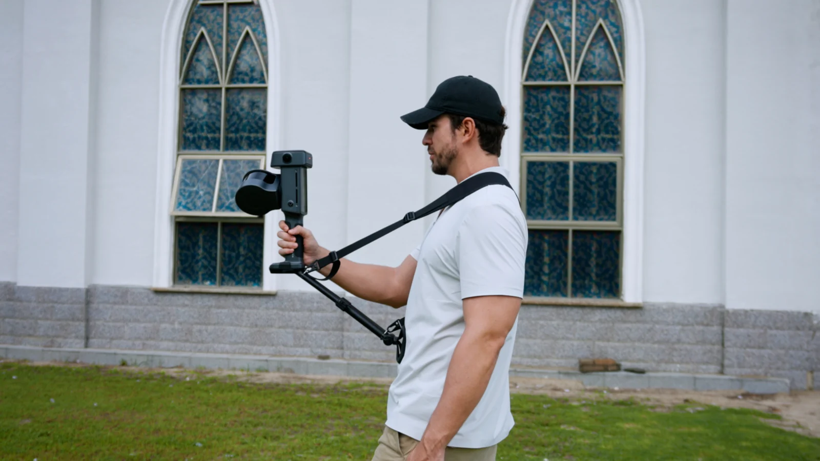
Support rig for all-day handheld capture
An optional support rig and shoulder strap transfer the ~2.5 kg load off the wrist for extended walkthroughs, while the integrated 4.3" display keeps coverage, trajectory, and RTK status in view without a second device.
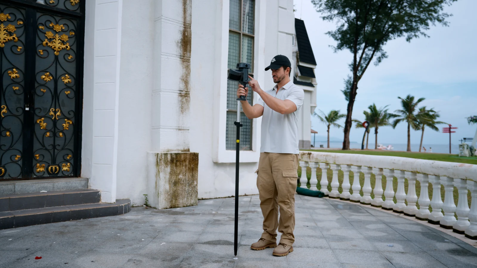
RTK survey-pole and control-point capture
The L3 mounts on a standard RTK survey pole for control-point collection and georeferencing, so it drops into existing survey workflows rather than replacing them — multi-GNSS RTK fixes to 0.8 cm + 1 ppm horizontal.
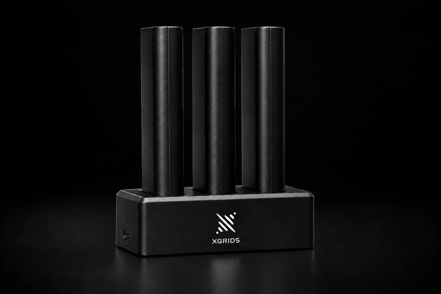
Quick-swap power, keep scanning
A 14.4 V / 3350 mAh battery runs about 100 minutes; quick-swap packs and the charging hub keep a crew capturing without returning to base. Under 30 W draw and a −20 to 50 °C operating range cover real field conditions.
A Local, No-Cloud Processing Ecosystem
The L3 pairs with LixelStudio, Lixel CyberColor, and dedicated plugins for game engines and BIM — every step runs locally, with no mandatory cloud subscription and no data-residency surprise.
LixelStudio to LCC, engines, and Revit
LixelStudio handles control-point-free map fusion, point-cloud editing, mesh generation, and automatic face and licence-plate privacy blurring. Lixel CyberColor (LCC) produces 3D Gaussian Splats; the LCC Plugin for UE brings them into Unreal Engine and NVIDIA Isaac Sim; and LCC for Revit drives a direct scan-to-BIM path. Everything runs on your own hardware.
Automatic Privacy Protection
LixelStudio automatically detects and blurs faces and licence plates in the captured imagery, so deliverables can be shared and published safely without manual redaction.
One Scanner Across Reality-Capture Industries
The L3 is built for high-accuracy, large-area capture in complex scenes — surveying, AEC, film, digital twin, energy and mining, and tunnels. Rev1 matches accessories, RTK strategy, and software to the work you actually do.
Topographic survey, corridor mapping, and as-built control with 5 mm relative and 2 cm absolute accuracy. Built-in RTK and survey-pole compatibility drop the L3 into existing geospatial workflows, exporting LAS / E57 straight into CAD and GIS.
Scan-to-BIM, renovation, and as-built documentation. The textured mesh and LCC for Revit plugin turn a single L3 capture into a BIM model directly from field data — no re-scan, no separate modeling pass.
Location scouting, previs, and virtual production. Lixel CyberColor turns the capture into a photoreal 3D Gaussian Splat for Unreal Engine set extension and previsualization from the same session as the survey cloud.
Asset inventory, facility management, and remote collaboration. High-accuracy, true-color point clouds and 3DGS build a spatially precise digital twin of a building, plant, or district that stakeholders can review remotely.
Plant and facility capture, stockpile and face measurement, and infrastructure inspection. The 120 m range and complex-scene stability cover large industrial sites in a single continuous walk.
Tunnels, utility corridors, and underground space where GNSS never reaches. Multi-modal SLAM holds absolute coordinates through long, featureless, repetitive runs without layering or drift.
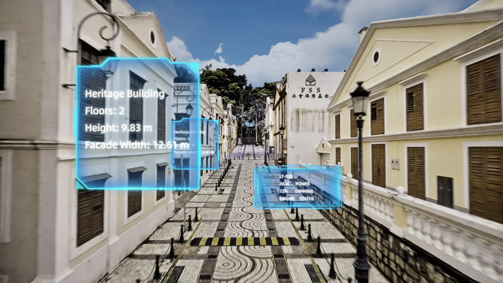
Digital twins of buildings, plants, and districts
A single high-accuracy capture becomes a spatially precise, true-color digital twin — the reference model for asset inventory, facility management, and remote collaboration across a whole site or city block.
Photoreal 3DGS for film and virtual production
Lixel CyberColor converts the capture into a 3D Gaussian Splat scene for location scouting, previs, and in-engine virtual production — a photoreal environment for Unreal Engine from the same field session as the measurable survey cloud.
Lixel L3 vs. Competing Handheld SLAM Systems
Buyers cross-shop the L3 against the premium-tier reference and established wearable and handheld SLAM systems — scanners with similar technology, priced at or above the L3. Here is where accuracy, built-in RTK, true-color imaging, and 3DGS output separate them; competitor street prices shown honestly (~).
| Capability | XGRIDS Lixel L3 | Leica BLK2GO | NavVis VLX | GeoSLAM ZEB Horizon |
|---|---|---|---|---|
| Relative accuracy | 5 mm post-processed (1σ) | 6–10 mm class | ~6 mm class (wearable) | 1–3 cm class |
| Absolute accuracy | 2 cm RMSE with built-in RTK | No built-in RTK | Control-point dependent | Control-point dependent |
| Built-in RTK | Yes — multi-GNSS | No | Optional / external | No |
| True-color imaging | 1/1.3" CMOS · 4K HDR | Panoramic, lower MP | Panoramic cameras | Optional add-on camera |
| 3D Gaussian Splat | Yes — Lixel CyberColor | No | No | No |
| Deliverables | Point cloud + mesh + 3DGS | Point cloud | Point cloud | Point cloud |
| On-board display | 4.3" — no phone needed | App / phone | Tablet-driven | No live display |
| Street price (~) | Request quote | ~$65,000+ | ~$70,000+ | ~$42,000 |
| Best fit | High-accuracy, large-area capture with RTK, true color, and 3DGS in one instrument | Premium compact handheld inside that vendor’s stack | Wearable mobile mapping for large indoor facilities | Established handheld SLAM benchmark, no RTK/3DGS |
XGRIDS Lixel L3 Technical Data
RESOURCES
Downloads & Technical Support
Everything you need to qualify and run your XGRIDS Lixel L3 with confidence.
WHY REV1 TECH
Authorized XGRIDS Reseller. Reality-Capture Specialists.
Rev1 Technologies is headquartered in Auburn Hills, MI, with direct expertise in mobile mapping, SLAM, and reality capture. Buying through Rev1 pairs the L3 with US-based application review and support — not a direct-import crate with no workflow ownership.
Lixel L3 Buyer Questions
What is the XGRIDS Lixel L3 used for?
The L3 is a flagship high-accuracy handheld SLAM LiDAR scanner for surveying and geospatial, AEC and BIM, film and virtual production, digital twins, energy and mining, and tunnels and utility corridors. A single walk-through produces a survey-grade true-color point cloud, a textured mesh, and a 3D Gaussian Splat — so one instrument covers measurement, modeling, and immersive review.
What does 5 mm accuracy actually mean on the L3?
5 mm is the post-processed relative accuracy (1σ), measured in a 500 m² test environment with no ground control points, referenced against a total station. Absolute accuracy is 2 cm RMSE horizontal and vertical with built-in RTK, and repeatability is 2 cm. In real time the L3 delivers 1 cm relative and 2.5 cm absolute RMSE, so the live cloud is already usable before post-processing.
Does the L3 work in complex environments where GPS is blocked?
Yes — this is a core design goal. RTK fused with multi-modal SLAM keeps the L3 stable in urban canyons (about 5 cm absolute when GNSS is blocked), in featureless and repetitive spaces such as tunnels and utility corridors without geometric layering, and near reflective water where false returns are rejected. The result is complete coverage on the first pass.
What deliverables come out of one L3 capture?
Three from the same session: a true-color point cloud (LAS, RCP, E57, PLY, iLAS) for measurement, a textured mesh (OSGB, OBJ) for modeling, and a 3D Gaussian Splat (LCC, LCC2, PLY) for immersive review and virtual production. The scanner also exports 3D Tiles (.3tz) and .usd. No second visit and no separate capture per format.
Can I use the point cloud in real time?
Yes. Multi-SLAM, vision-aided localization, and AI dynamic-object filtering run on-device, so the cloud is measurable the moment you stop walking — reviewed live on the built-in 1000-nit 4.3" touchscreen at 1 cm relative and 2.5 cm absolute RMSE. Gaps and coverage issues are caught on site instead of back in the office.
How does the L3 fit into a survey and CAD/BIM workflow?
The L3 mounts on a standard RTK survey pole for control-point collection and georeferencing, and outputs open formats (LAS, E57, PLY, OBJ) that drop into AutoCAD, Civil 3D, Revit, ArcGIS, and QGIS. LixelStudio handles control-point-free map fusion and mesh generation locally, and LCC for Revit provides a direct scan-to-BIM path from the same capture.
Do I need a phone or laptop to operate the L3?
No. The L3 has an integrated 4.3" TFT touchscreen at 1000 nits, so coverage, trajectory, RTK status, and the live point cloud are all visible on the device itself — a single operator can capture, review, and confirm quality without tethering to a phone or field laptop.
How does the L3 compare to the Leica BLK2GO or GeoSLAM ZEB Horizon?
The L3 adds built-in multi-GNSS RTK, a 1/1.3" true-color 4K HDR camera system, and native 3D Gaussian Splat output — none of which the BLK2GO or ZEB Horizon deliver in one instrument — while landing well below the premium-tier price band. Rev1 will compare the L3 head-to-head against the systems you are cross-shopping during the quote.
Is the processing software cloud-based or local?
Everything runs locally. LixelStudio, Lixel CyberColor, the LCC Plugin for Unreal Engine and NVIDIA Isaac Sim, and LCC for Revit all process on your own hardware — no mandatory cloud subscription and no data-residency surprise, which matters for regulated survey, government, and infrastructure work.
How long does the L3 run in the field?
A 14.4 V / 3350 mAh battery provides about 100 minutes of operating time at under 30 W draw. Quick-swap packs and the standard charging hub keep a crew scanning without returning to base, and the IP54 aluminium body operates from −20 °C to 50 °C.
Is business financing available through Rev1?
Yes. Rev1 Technologies offers business financing for qualified buyers across the full L3 package — scanner, accessories, and software in a single financed proposal. Contact Rev1 for a current term sheet and a quote tailored to your configuration.